Settings
The plugin can be configured through the QGIS Settings | Options… menu in the Processing | Providers | Open Data Cube section.
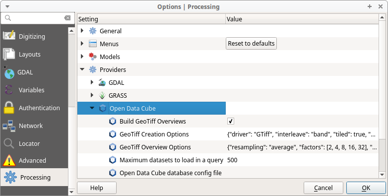
Open Data Cube database config file
| Type: | File path |
|---|---|
| Notes: | Path to an Open Data Cube config file. If not set, the Open Data Cube library will look for a config file in some default locations. |
Maximum datasets to load in a query
| Type: | Integer |
|---|---|
| Notes: | The plugin can and will load every available dataset that matches your query. This can cause memory issues and will certainly be slow for large numbers of datasets. If a query will return data from more than the maximum specified in this settings, the query will not execute and a message will be displayed. |
| Default: | 500 |
Build GeoTiff Overviews
| Type: | Checkbox |
|---|---|
| Notes: | If checked, the plugin will build overviews/pyramids for the returned data to speed up rendering. |
| Default: | checked |
GeoTiff Creation Options
| Type: | JSON |
|---|---|
| Notes: | A valid JSON string that contains rasterio
creation options. |
| Default: | {"driver": "GTiff", "interleave": "band", "tiled": true, "blockxsize": 256, "blockysize": 256, "compress": "lzw", "predictor": 1, "tfw": false, "jpeg_quality": 75, "profile": "GDALGeoTIFF", "bigtiff": "IF_NEEDED", "geotiff_keys_flavor": "STANDARD", "photometric": "RGBA"} |